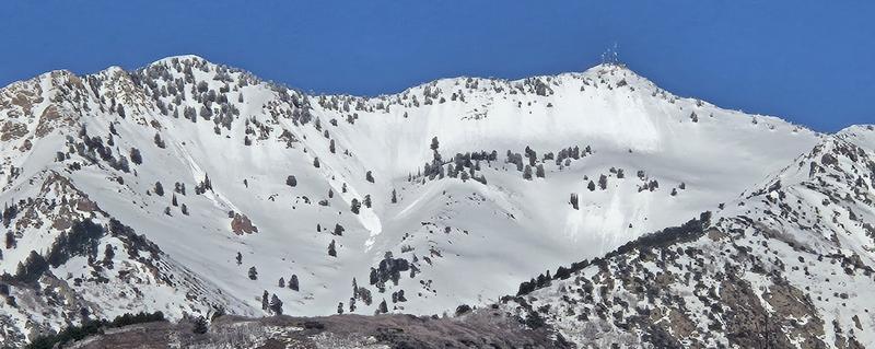
Forecast for the Ogden Area Mountains

McKinley Talty
Issued by McKinley Talty on
Tuesday morning, April 8, 2025
Overall, the avalanche danger is LOW, and normal caution is advised. Natural and human-triggered avalanches are unlikely, watch for unstable snow in isolated or extreme terrain.
Slightly cooler temperatures compared to yesterday and strong winds should keep wet snow problems at bay. However, solar radiation, whether from brief periods of strong sunshine or from greenhouse effects where heat is trapped beneath thin cloud cover, may increase the potential for wet loose avalanches on east, south, and west-facing slopes, where the danger could rise to MODERATE.
Practice safe travel protocol and keep an eye out for damp snow and roller balls, which are signs to head for shadier slopes.
Forecast reviewed and approved by Nikki Champion
Low
Moderate
Considerable
High
Extreme
Learn how to read the forecast here
Special Announcements
Motorized Users—Please consider taking this 5-minute survey to help researchers better understand avalanche education participation and safety preparedness. Responses are anonymous and confidential.
Weather and Snow
This morning, the skies are partly cloudy, and mountain temperatures range from 35 to 45 °F. Strong winds entered the region yesterday evening and have been blowing from the West at 25 to 45 mph at the upper elevations, gusting to 55 mph. Along mid-elevation ridgelines, western winds have been blowing 15-20 mph. No new snow has fallen since April 3.
For today, expect partly cloudy skies with slightly cooler temperatures than yesterday, warming to the mid 40s °F. West winds along upper-elevation ridgelines will remain steady at 20-30 mph, with mid-elevation winds blowing 15-20 mph.
Recent Avalanches
No new avalanches were reported to the UAC yesterday in the Ogden mountains. Evidence of a wet-loose avalanche cycle from the weekend is prevalent in the mountains, as noted by Derek DeBruin in his observation from Saturday.
Ad
Avalanche Problem #1
Normal Caution
Type
Location
Likelihood
Size
Description
The snowpack is generally stable. Natural and human-triggered avalanches are unlikely, although remain possible in extreme terrain. Normal Caution is used when conditions are broadly safe and there is no predominant avalanche problem. While any avalanche type is possible, the most likely concerns are loose wet, loose dry, or shallow wind slab avalanches.
Continue to assess snow and weather as you travel as "Normal Caution" does not mean green-light conditions. Continue to practice safe travel protocol, especially in isolated areas where you may encounter:
  1. Wet Snow: Temperatures warming to the mid 40s °F paired with partly cloudy skies may lead to a greenhouse effect throughout the day. Keep an eye out for active roller-balls, as this is a sign that snow surfaces are warming up. If skies clear more than expected, any slopes exposed to sunlight may quickly loose stability.
  2. Wind-Drifted Snow: While soft snow available for transport from the wind has diminished, strong west winds may create shallow slabs of wind-drifted snow. Rounded pillows that crack or collapse underfoot are clear signs of sensitive wind slabs and should be treated with caution.
  3. Cornices and Roof Avalanches: Give both a wide berth—whether you’re above, below, or beside them. Rising temperatures can cause cornices to calve and fail, and may break back further than expected.
General Announcements
This information does not apply to developed ski areas or highways where avalanche control is normally done. This forecast is from the U.S.D.A. Forest Service, which is solely responsible for its content. This forecast describes general avalanche conditions and local variations always occur.