Forecast for the Moab Area Mountains

Issued by Eric Trenbeath on
Saturday morning, April 5, 2025
Saturday morning, April 5, 2025
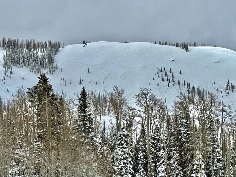
Heightened avalanche conditions exist and the danger is MODERATE on steep, wind drifted slopes on all aspects above treeline, and on slopes that face NW-N-NE-E near treeline. Human triggered avalanches involving recent deposits of wind drifted snow are possible. Triggered wind slabs may run farther than you expect on slick, hard surfaces underneath. Keep this in mind when in consequential terrain.
Under a strong sun today, the danger may rise to MODERATE for loose wet avalanche activity on steep, sun exposed slopes. Signs of instability include rollerballs, pinwheels, and sloppy wet snow. Stay off of and out from under steep slopes when these signs are present.
Becoming more the exception than the rule, it may still be possible to trigger a deep hard slab avalanche failing on buried persistent weak layers. This problem exists near treeline and above on slopes facing NW-N-NE-E and the danger remains MODERATE. Very steep slopes with a shallow snowpack are the most suspect areas.

Low
Moderate
Considerable
High
Extreme
Learn how to read the forecast here