
Forecast for the Salt Lake Area Mountains

Issued by Nikki Champion on
Monday morning, January 4, 2021
Monday morning, January 4, 2021
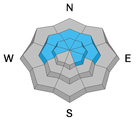
The most likely place to trigger an avalanche today will be upper elevation slopes facing west through north through southeast where fresh slabs of wind drifted snow sit atop weak faceted snow. The avalanche danger is CONSIDERABLE in these locations. Cautious route-finding and conservative decision-making skills are essential today.
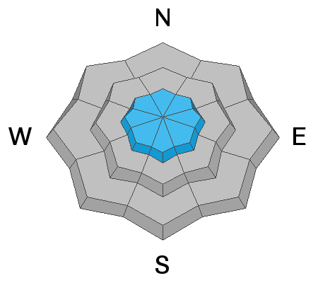
The avalanche danger is MODERATE on all other steep upper elevation slopes. You will also find a MODERATE avalanche danger on steep slopes facing west to north to southeast at the mid-elevations.
All other aspects have a LOW avalanche danger.
Pay attention to changing conditions ahead of Tuesday's storm, heavy snowfall and increased winds will cause the avalanche danger to rise throughout the night.
Low
Moderate
Considerable
High
Extreme
Learn how to read the forecast here